
Ontario has over 34,000 kilometres of snowmobile trails, operated and maintained by the OFSC, its districts, member clubs and most importantly, countless volunteers. Please consider getting involved by contacting the West Carleton volunteer coordinator. It’s a great way to meet people with similar interests, and you can devote as little – or as much time as you are able to helping make our club and our trails something to be proud of!
Trails within the City Of Ottawa
Our club, along with another 4 clubs in our district, have trails that run on City of Ottawa land. This includes rights of way on unmaintained roads, trails that run alongside city roads, and multi-use trails in parks. Our District, Upper Canada Snowmobile Region, has worked with the city to obtain a land use agreement. We would like all snowmobilers using our trail system within Ottawa to go to the following link and review the expectations that are expected of us when snowmobiling on City of Ottawa property.
Using Snowmobile Trails In Ottawa.
Maps and Trail Conditions
The OFSC has been hard at work developing the new Interactive Trail Guide – an online resource for planning your trip, and checking out trail conditions. The guide allows you to view interactive maps of all OFSC Prescribed Trails, and instantly see the most recent report on trail conditions. Or, for immediate updates of the last reported trail conditions in West Carleton, please visit the Trail Talk section in this web site’s Forum area.
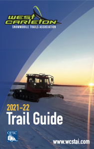
WCSTA Trail Guide 2021-2022
There have been quite a few changes and some exciting new additions to West Carleton trails for the 2021 – 2022 season. To see our latest trail routes, download a PDF Trail Guide, or pick up a printed copy when you’re visiting local club supporters and businesses!
|

|